
Proposed office rezoning raises Commissioner concerns
-
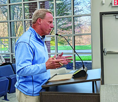
Applicant Jeffrey Marzolf, owner of Marzolf Investment, pleads his rezoning request before Farragut Municipal Planning Commissioners. - Tammy Cheek
-
- Tammy Cheek
A Cedar Bluff business owner wants to rezone an 8.1-acre parcel behind the new Turner Homes property for a financial planning office.
But, he met resistance from Farragut Municipal Planning Commission members during a workshop Thursday, March 19.
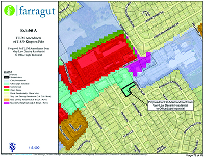
The property at 11830 Kingston Pike is currently zoned Very Low Density Residential. Applicant Jeffrey Marzolf, owner of Marzolf Investment, is asking to amend the Town’s Future Land Use Map from Very Low Density Residential to Office/Light Industrial. He also wants to change the zoning from General Single Family Residential, or R-2, to Office.
“I’m not looking for some short-term thing,” Marzolf said. “I’m looking to make an investment.
“The only way this project really works for me is if I can use the existing house,” he said, noting the house is an old, dilapidated 1960s-style building. He wants to renovate and repurpose it.
“I don’t think it would impact anybody in the subdivision,” Marzolf added.
While the Commission took no action on the requests, several members voiced concerns.
“My concern is, somewhere down the road, you turn that over to somebody else — what would they do with that space if it’s rezoned?” Chairman Ron Pinchok asked.
“My concern is it currently is surrounded by six residential properties,” Commissioner Louise Povlin said. “Once you rezone this and you allow offices to come in, you are opening up the door to precedent.”
She added that she believes rezoning the property residential was “the right decision.”
Commissioner Jon Greene agreed with Povlin and said that if the house were used for a business, it could not be rebuilt as a house. Instead, it would have to be rebuilt as commercial property, which could be too costly.
“I want to know the limits of what could be placed on there,” Commissioner Shannon Preston said. “I agree with Louise, but also, who would build a house there?”
Commissioner Jeff Devlin recommended, and other commissioners agreed, that Marzolf should reach out to the Farragut Crossing Homeowners Association.
Marzolf said he would be willing to talk with residents.
“I don’t think there’s anything realistically they have to fear,” he added.
Farragut Crossing resident Mary Ellen Branan said she “really didn’t have an issue” with the requests, but asked how Marzolf planned to access the property. She added she preferred he use the access easement and not Federal Boulevard.
Marzolf said he would use the easement behind Turner Homes.
Because the property owner is an affiliate broker with his real estate company, Commissioner Noah Myers recused himself from discussion of the requests.
“The Future Land Use Map is not a property line map, so it’s that general area,” Community Development director Mark Shipley said. “This area, that parcel, historically has been used for both residential and office purposes. Most recently, it was used as an insurance office for several years.
“There’s actually a parking lot on the south side of the existing building, which is a ’70s rancher,” he added. “To the north of this, you have a parking lot for two other office buildings. Those are actually on property zoned commercial, but on the Future Land Use Map, they are designated as Office/Light Industrial.
“The property in question is part of the larger tract that, back in 2020, was rezoned from Office to General Single Family Residential,” Shipley said. “The intent at the time was to provide for three residential lots.
“So it had been Office in the past, then it got changed back to Residential,” he said.
Shipley said the current owner had divided the original 8-acre tract into three lots. The northernmost lot, a little more than an acre, is the subject of the Future Land Use Map amendment and rezoning requests.
“The other two parcels are not part of that,” Shipley added. “From the staff’s perspective, anytime you amend the map, it is whether what they’re requesting is appropriate for that area, given the surrounding context.”